
La Libertad topographic map
Interactive map
Click on the map to display elevation.
About this map
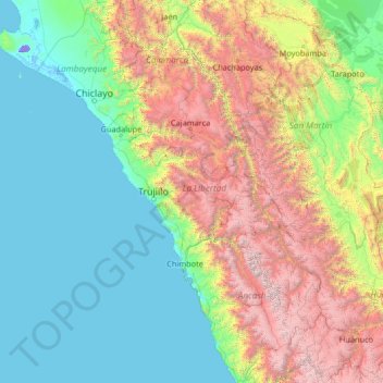
Name: La Libertad topographic map, elevation, terrain.
Location: La Libertad, Peru (-10.60000 -81.10000 -5.40000 -75.90000)
Average elevation: 4,091 ft
Minimum elevation: -82 ft
Maximum elevation: 20,436 ft