
Apetlon topographic map
Interactive map
Click on the map to display elevation.
About this map
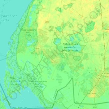
Name: Apetlon topographic map, elevation, terrain.
Location: Apetlon, Bezirk Neusiedl am See, Burgenland, 7143, Autriche (47.68143 16.73982 47.82413 16.90873)
Average elevation: 381 ft
Minimum elevation: 354 ft
Maximum elevation: 413 ft