
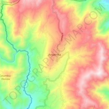
Anserma topographic map
Interactive map
Click on the map to display elevation.
About this map
Name: Anserma topographic map, elevation, terrain.
Location: Anserma, Bajo Occidente, Caldas, Colombia (5.19375 -75.82566 5.27375 -75.74566)
Average elevation: 5,285 ft
Minimum elevation: 3,566 ft
Maximum elevation: 6,857 ft