
Isugan topographic map
Interactive map
Click on the map to display elevation.
About this map
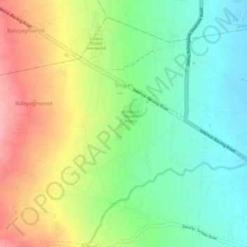
Name: Isugan topographic map, elevation, terrain.
Location: Isugan, Bacong, Negros Oriental, Central Visayas, Philippines (9.25037 123.26338 9.27370 123.27683)
Average elevation: 344 ft
Minimum elevation: 141 ft
Maximum elevation: 600 ft
Other topographic maps
Click on a map to view its topography, its elevation and its terrain.
Bacong
Philippines > Negros Oriental > Bacong
Bacong, Negros Oriental, Central Visayas, 6216, Philippines
Average elevation: 118 ft