
Hamme topographic map
Interactive map
Click on the map to display elevation.
About this map
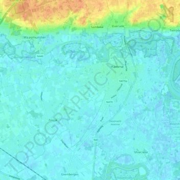
Name: Hamme topographic map, elevation, terrain.
Location: Hamme, Dendermonde, East Flanders, Flanders, Belgium (51.06487 4.05962 51.11148 4.17596)
Average elevation: 20 ft
Minimum elevation: -10 ft
Maximum elevation: 108 ft