
Victoria Island topographic map
Interactive map
Click on the map to display elevation.
About this map
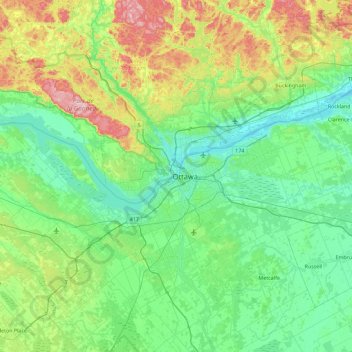
Name: Victoria Island topographic map, elevation, terrain.
Average elevation: 413 ft
Minimum elevation: 125 ft
Maximum elevation: 1,424 ft
Other topographic maps
Click on a map to view its topography, its elevation and its terrain.
Cumberland
Kanada > Ontario > Ottawa > Cumberland
Cumberland, Ottawa, Eastern Ontario, Ontario, Kanada
Average elevation: 246 ft
Orléans
Kanada > Ontario > Ottawa > Cumberland
Orléans, Cumberland, Ottawa, Ontario, Kanada
Average elevation: 217 ft