
Erpion topographic map
Interactive map
Click on the map to display elevation.
About this map
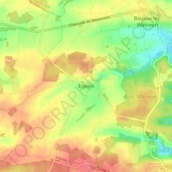
Name: Erpion topographic map, elevation, terrain.
Location: Erpion, Froidchapelle, Thuin, Hainaut, Wallonie, 6441, Belgique (50.19128 4.33430 50.23128 4.37430)
Average elevation: 794 ft
Minimum elevation: 676 ft
Maximum elevation: 889 ft