Geolocate

Gopalpur topographic map

Click on the map to display elevation.

About this map

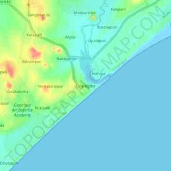
Name: Gopalpur topographic map, elevation, terrain.

Location: Gopalpur, Rangeilunda, Ganjam, Odisha, 761002, India (19.21989 84.86517 19.29989 84.94517)

Average elevation: 36 ft

Minimum elevation: 0 ft

Maximum elevation: 187 ft

Gear up for your next adventure:

📚Navigation Handbooks - Master the art of reading topographic maps and using a compass
🧤Hiking Gloves - Protective gloves for rugged trails
💧Water Filtration Bottles - Safely drink from streams and lakes while exploring
🛌Ultralight Sleeping Bags - Compact down bags for cold nights in the wilderness
❄️Traction Cleats - Prevent slips on icy trails during winter hikes

As an Amazon Associate, this site earns from qualifying purchases at no extra cost to you.