
Thank you for supporting this site ❤️
Make a donation
Make a donation
Gear up for your next adventure:
As an Amazon Associate, this site earns from qualifying purchases at no extra cost to you.
Meppen topographic map
Click on the map to display elevation.
Thank you for supporting this site ❤️
Make a donation
Make a donation
Gear up for your next adventure:
As an Amazon Associate, this site earns from qualifying purchases at no extra cost to you.
About this map
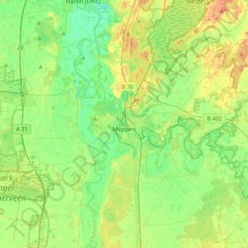
Name: Meppen topographic map, elevation, terrain.
Location: Meppen, Landkreis Emsland, Lower Saxony, 49716, Germany (52.62253 7.13514 52.77429 7.44119)
Average elevation: 62 ft
Minimum elevation: 16 ft
Maximum elevation: 128 ft
Thank you for supporting this site ❤️
Make a donation
Make a donation
Gear up for your next adventure:
As an Amazon Associate, this site earns from qualifying purchases at no extra cost to you.