
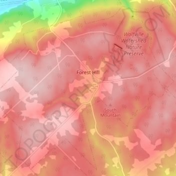
Forest Hill topographic map
Interactive map
Click on the map to display elevation.
About this map
Name: Forest Hill topographic map, elevation, terrain.
Average elevation: 604 ft
Minimum elevation: 56 ft
Maximum elevation: 778 ft
Other topographic maps
Click on a map to view its topography, its elevation and its terrain.
Canning
Canada > Nova Scotia > Municipality of the County of Kings
Canning, Municipality of the County of Kings, Kings County, Nova Scotia, B0P 1H0, Canada
Average elevation: 72 ft
Ross Creek
Canada > Nova Scotia > Municipality of the County of Kings
Ross Creek, Municipality of the County of Kings, Kings County, Nova Scotia, B0P 1H0, Canada
Average elevation: 328 ft
Tremont
Canada > Nova Scotia > Municipality of the County of Kings
Tremont, Municipality of the County of Kings, Kings County, Nova Scotia, B0P 1R0, Canada
Average elevation: 190 ft
Greenwood
Canada > Nova Scotia > Municipality of the County of Kings
Greenwood, Municipality of the County of Kings, Kings County, Nova Scotia, B0P 1N0, Canada
Average elevation: 92 ft