
Vigne topographic map
Interactive map
Click on the map to display elevation.
About this map
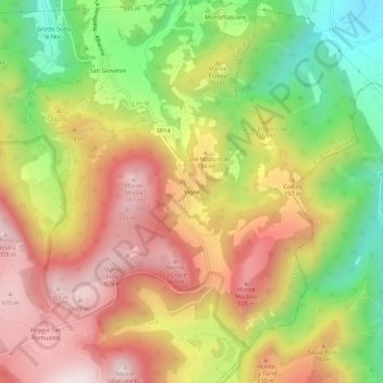
Name: Vigne topographic map, elevation, terrain.
Location: Vigne, Fabriano, Ancona, Marches, Italie (43.36027 13.02751 43.40027 13.06751)
Average elevation: 2,211 ft
Minimum elevation: 994 ft
Maximum elevation: 3,314 ft
Other topographic maps
Click on a map to view its topography, its elevation and its terrain.