
Baniyari topographic map
Interactive map
Click on the map to display elevation.
About this map
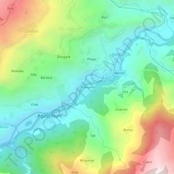
Name: Baniyari topographic map, elevation, terrain.
Location: Baniyari, Agastmuni, Rudraprayag, Uttarakhand, 246421, India (30.37853 79.01606 30.41853 79.05606)
Average elevation: 3,773 ft
Minimum elevation: 2,474 ft
Maximum elevation: 6,421 ft