San Rafael topographic map
Interactive map
Click on the map to display elevation.
About this map
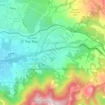
Name: San Rafael topographic map, elevation, terrain.
Average elevation: 4,843 ft
Minimum elevation: 4,170 ft
Maximum elevation: 6,102 ft

Click on the map to display elevation.
Name: San Rafael topographic map, elevation, terrain.
Average elevation: 4,843 ft
Minimum elevation: 4,170 ft
Maximum elevation: 6,102 ft