
Zechlinerhütte topographic map
Interactive map
Click on the map to display elevation.
About this map
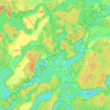
Name: Zechlinerhütte topographic map, elevation, terrain.
Average elevation: 217 ft
Minimum elevation: 154 ft
Maximum elevation: 282 ft
Other topographic maps
Click on a map to view its topography, its elevation and its terrain.
Großer Stechlinsee
Deutschland > Brandenburg > Rheinsberg
Großer Stechlinsee, Uferweg, Rheinsberg, Ostprignitz-Ruppin, Brandenburg, 16831, Deutschland
Average elevation: 236 ft