
Achouffe topographic map
Interactive map
Click on the map to display elevation.
About this map
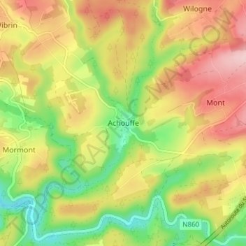
Name: Achouffe topographic map, elevation, terrain.
Location: Achouffe, Bastenaken, Luxemburg, Wallonië, 6660, België (50.13017 5.72545 50.17017 5.76545)
Average elevation: 1,273 ft
Minimum elevation: 951 ft
Maximum elevation: 1,594 ft