
Lambayeque topographic map
Interactive map
Click on the map to display elevation.
About this map
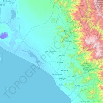
Name: Lambayeque topographic map, elevation, terrain.
Location: Lambayeque, Pérou (-7.17713 -80.62713 -5.48039 -79.12085)
Average elevation: 1,483 ft
Minimum elevation: -82 ft
Maximum elevation: 13,268 ft
Other topographic maps
Click on a map to view its topography, its elevation and its terrain.
Chiclayo
Pérou > Lambayeque > Pucalá
Chiclayo, Pucalá, Chiclayo, Lambayeque, Pérou
Average elevation: 1,142 ft