
El Pucé topographic map
Interactive map
Click on the map to display elevation.
About this map
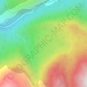
Name: El Pucé topographic map, elevation, terrain.
Location: El Pucé, Plan, Sobrarbe, Huesca, Aragon, 22366, Espagne (42.54612 0.28504 42.56612 0.30504)
Average elevation: 5,302 ft
Minimum elevation: 2,995 ft
Maximum elevation: 8,317 ft
Other topographic maps
Click on a map to view its topography, its elevation and its terrain.