Geolocate

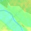
Horodyshche topographic map

Click on the map to display elevation.

About this map

Name: Horodyshche topographic map, elevation, terrain.

Location: Horodyshche, Berezne Urban Hromada, Rivne Raion, Rivne Oblast, 34607, Ukraine (51.00773 26.71283 51.05061 26.75295)

Average elevation: 541 ft

Minimum elevation: 509 ft

Maximum elevation: 577 ft

Other topographic maps

Click on a map to view its topography, its elevation and its terrain.
Zarichne

Ukraine > Rivne Oblast

Average elevation: 479 ft

Хотин

Ukraine > Rivne Oblast > Khotyn

Average elevation: 551 ft

Gear up for your next adventure:

📶Satellite Messenger - Communication device off‑grid
🌎3D Topographic Globes - Raised relief globes for a tactile understanding of geography
🔦Compact Flashlight - Reliable flashlight for emergencies
🪶Multi‑Purpose Knife - Useful blade for camp and trail
🥾Men's Hiking Boots - Durable, waterproof footwear for rugged terrain and steep inclines

As an Amazon Associate, this site earns from qualifying purchases at no extra cost to you.