
Uvira topographic map
Interactive map
Click on the map to display elevation.
About this map
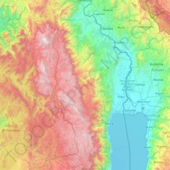
Name: Uvira topographic map, elevation, terrain.
Location: Uvira, South Kivu, DR Congo (-3.65909 28.78232 -2.73800 29.26094)
Average elevation: 5,722 ft
Minimum elevation: 2,497 ft
Maximum elevation: 11,280 ft