
Taşlıca topographic map
Interactive map
Click on the map to display elevation.
About this map
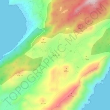
Name: Taşlıca topographic map, elevation, terrain.
Location: Taşlıca, Marmaris, Muğla, Aegean Region, Turkey (36.61360 28.08905 36.65360 28.12905)
Average elevation: 774 ft
Minimum elevation: -16 ft
Maximum elevation: 1,932 ft