
Thank you for supporting this site ❤️
Make a donation
Make a donation
Gear up for your next adventure:
As an Amazon Associate, this site earns from qualifying purchases at no extra cost to you.
Mindo topographic map
Click on the map to display elevation.
Thank you for supporting this site ❤️
Make a donation
Make a donation
Gear up for your next adventure:
As an Amazon Associate, this site earns from qualifying purchases at no extra cost to you.
About this map
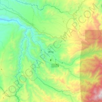
Name: Mindo topographic map, elevation, terrain.
Location: Mindo, San Miguel de Los Bancos, Pichincha, Ecuador (-0.13745 -78.83516 0.03437 -78.64655)
Average elevation: 5,377 ft
Minimum elevation: 2,890 ft
Maximum elevation: 10,226 ft
Thank you for supporting this site ❤️
Make a donation
Make a donation
Gear up for your next adventure:
As an Amazon Associate, this site earns from qualifying purchases at no extra cost to you.