
Village of Brownville topographic map
Interactive map
Click on the map to display elevation.
About this map
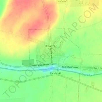
Name: Village of Brownville topographic map, elevation, terrain.
Average elevation: 361 ft
Minimum elevation: 256 ft
Maximum elevation: 453 ft
Other topographic maps
Click on a map to view its topography, its elevation and its terrain.
Village of Dexter
United States > New York > Jefferson County > Town of Brownville
Village of Dexter, Town of Brownville, Jefferson County, New York, United States
Average elevation: 315 ft