Geolocate

Desert topographic map

Click on the map to display elevation.

About this map

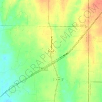
Name: Desert topographic map, elevation, terrain.

Location: Desert, Collin County, Texas, United States (33.36836 -96.42210 33.40836 -96.38210)

Average elevation: 676 ft

Minimum elevation: 587 ft

Maximum elevation: 758 ft

Collin County trails, hiking, mountain biking, running and outdoor activities

Other topographic maps

Click on a map to view its topography, its elevation and its terrain.

Parker

United States > Texas > Collin County

Average elevation: 591 ft

Celina

United States > Texas > Collin County

Average elevation: 686 ft

Fairview

United States > Texas > Collin County

Average elevation: 630 ft

Chisholm Trail

United States > Texas > Collin County > Plano

Average elevation: 689 ft

Panther Creek

United States > Texas > Collin County > Frisco

Average elevation: 646 ft

White Rock Creek

United States > Texas > Collin County > Plano

Average elevation: 656 ft

Lavon Lake

United States > Texas > Collin County > Wylie

Average elevation: 545 ft

Gear up for your next adventure:

🔦Compact Flashlight - Reliable flashlight for emergencies
🔌USB Car Charger - Car charger for on‑the‑go power needs
🧦Merino Wool Socks - Moisture-wicking, blister-preventing socks for long treks
🥾Hiking Shoes - Durable and comfortable shoes for trail hiking
🔭Compact Binoculars - HD vision for scouting terrain and identifying distant landmarks

As an Amazon Associate, this site earns from qualifying purchases at no extra cost to you.