
富里鄉 topographic map
Interactive map
Click on the map to display elevation.
About this map
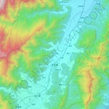
Name: 富里鄉 topographic map, elevation, terrain.
Location: 富里鄉, Comté de Hualien, 983, Taïwan (23.09778 121.21207 23.29960 121.37875)
Average elevation: 2,352 ft
Minimum elevation: 407 ft
Maximum elevation: 8,842 ft
Other topographic maps
Click on a map to view its topography, its elevation and its terrain.