
Cocales topographic map
Interactive map
Click on the map to display elevation.
About this map
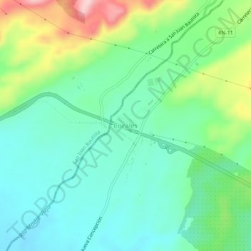
Name: Cocales topographic map, elevation, terrain.
Location: Cocales, Patulul, Suchitepéquez, 10014, Guatemala (14.37447 -91.21829 14.41447 -91.17829)
Average elevation: 823 ft
Minimum elevation: 604 ft
Maximum elevation: 1,348 ft