
Tiruchitrambalam topographic map
Interactive map
Click on the map to display elevation.
About this map
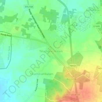
Name: Tiruchitrambalam topographic map, elevation, terrain.
Average elevation: 121 ft
Minimum elevation: 59 ft
Maximum elevation: 207 ft
Other topographic maps
Click on a map to view its topography, its elevation and its terrain.
Morattandi
India > Tamil Nadu > Vanur
Morattandi, Vanur, Viluppuram District, Tamil Nadu, 605111, India
Average elevation: 148 ft
Auroville
India > Tamil Nadu > Vanur
Auroville, Vanur, Viluppuram District, Tamil Nadu, 605101, India
Average elevation: 118 ft