
凤凰观景平台 topographic map
Interactive map
Click on the map to display elevation.
About this map
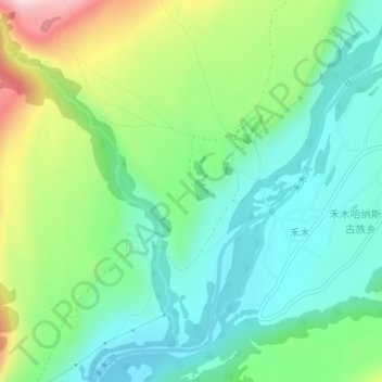
Name: 凤凰观景平台 topographic map, elevation, terrain.
Location: 凤凰观景平台, 禾木桥, 禾木, 禾木哈纳斯蒙古民族乡, 布尔津县, 伊犁哈萨克自治州, 新疆维吾尔自治区, 中国 (48.57202 87.41866 48.57212 87.41876)
Average elevation: 3,835 ft
Minimum elevation: 3,504 ft
Maximum elevation: 4,577 ft
Other topographic maps
Click on a map to view its topography, its elevation and its terrain.