Geolocate

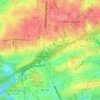
Patton Chapel topographic map

Click on the map to display elevation.

About this map

Name: Patton Chapel topographic map, elevation, terrain.

Location: Patton Chapel, Hoover, Jefferson County, Alabama, 35216, United States (33.37428 -86.81804 33.41428 -86.77804)

Average elevation: 541 ft

Minimum elevation: 394 ft

Maximum elevation: 850 ft

Jefferson County trails, hiking, mountain biking, running and outdoor activities

Other topographic maps

Click on a map to view its topography, its elevation and its terrain.
Howard Lake

United States > Alabama > Jefferson County > Hoover

Average elevation: 548 ft

Gear up for your next adventure:

📱Solar Portable Charger - Solar power bank for charging devices off‑grid
🪑Ultralight Camp Chairs - Portable seating for resting after a long day of mapping
🔦Powerful Headlamps - Ultra-bright hands-free lighting for night navigation
👟Men's Trail Runners - Lightweight footwear for fast-paced exploration and light hiking
🖼️Topo Map Wall Art - Decorative topographic prints of famous peaks and regions

As an Amazon Associate, this site earns from qualifying purchases at no extra cost to you.