
Phường Thuận Phước topographic map
Interactive map
Click on the map to display elevation.
About this map
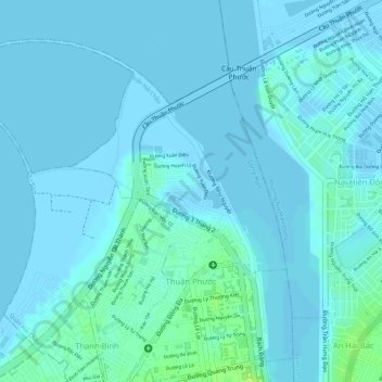
Name: Phường Thuận Phước topographic map, elevation, terrain.
Location: Phường Thuận Phước, Hải Châu District, Đà Nẵng, Vietnam (16.07691 108.20414 16.09843 108.22603)
Average elevation: 10 ft
Minimum elevation: -10 ft
Maximum elevation: 43 ft
Other topographic maps
Click on a map to view its topography, its elevation and its terrain.