
Thank you for supporting this site ❤️
Make a donation
Make a donation
Gear up for your next adventure:
As an Amazon Associate, this site earns from qualifying purchases at no extra cost to you.
Zumpango topographic map
Click on the map to display elevation.
Thank you for supporting this site ❤️
Make a donation
Make a donation
Gear up for your next adventure:
As an Amazon Associate, this site earns from qualifying purchases at no extra cost to you.
About this map
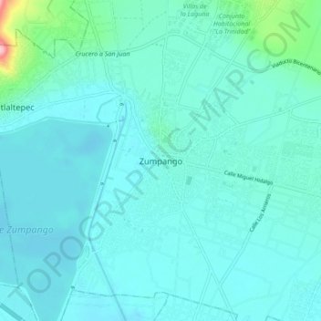
Name: Zumpango topographic map, elevation, terrain.
Location: Zumpango, State of Mexico, 55600, Mexico (19.75729 -99.14073 19.83729 -99.06073)
Average elevation: 7,405 ft
Minimum elevation: 7,336 ft
Maximum elevation: 7,943 ft
Thank you for supporting this site ❤️
Make a donation
Make a donation
Gear up for your next adventure:
As an Amazon Associate, this site earns from qualifying purchases at no extra cost to you.