
Lomme topographic map
Interactive map
Click on the map to display elevation.
About this map
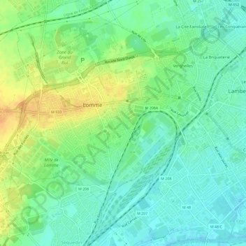
Name: Lomme topographic map, elevation, terrain.
Average elevation: 105 ft
Minimum elevation: 62 ft
Maximum elevation: 167 ft
Other topographic maps
Click on a map to view its topography, its elevation and its terrain.
Lille
Frankreich > Nordfrankreich > Lille
Lille, Nord, Nordfrankreich, Metropolitanes Frankreich, Frankreich
Average elevation: 105 ft