
Punta Nord di Fanes topographic map
Interactive map
Click on the map to display elevation.
About this map
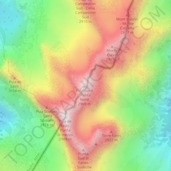
Name: Punta Nord di Fanes topographic map, elevation, terrain.
Average elevation: 8,074 ft
Minimum elevation: 6,568 ft
Maximum elevation: 9,718 ft