
Cerro Caneten topographic map
Interactive map
Click on the map to display elevation.
About this map
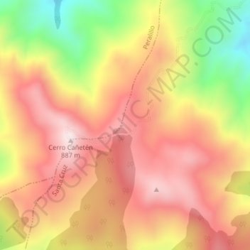
Name: Cerro Caneten topographic map, elevation, terrain.
Average elevation: 2,260 ft
Minimum elevation: 1,152 ft
Maximum elevation: 3,002 ft
Other topographic maps
Click on a map to view its topography, its elevation and its terrain.
Cerro Machamoya
Chile > Región del Libertador General Bernardo O'Higgins > Santa Cruz
Cerro Machamoya, Santa Cruz, Provincia de Colchagua, Región del Libertador General Bernardo O'Higgins, Chile
Average elevation: 1,644 ft
La Patagüilla
Chile > Región del Libertador General Bernardo O'Higgins > Santa Cruz > La Patagüilla
La Patagüilla, Santa Cruz, Provincia de Colchagua, Región del Libertador General Bernardo O'Higgins, 3130000, Chile
Average elevation: 558 ft