
Thank you for supporting this site ❤️
Make a donation
Make a donation
Gear up for your next adventure:
As an Amazon Associate, this site earns from qualifying purchases at no extra cost to you.
Yozgat topographic map
Click on the map to display elevation.
Thank you for supporting this site ❤️
Make a donation
Make a donation
Gear up for your next adventure:
As an Amazon Associate, this site earns from qualifying purchases at no extra cost to you.
About this map
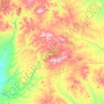
Name: Yozgat topographic map, elevation, terrain.
Location: Yozgat, Central Anatolia Region, 66100, Turkey (39.66220 34.64810 39.98220 34.96810)
Average elevation: 4,101 ft
Minimum elevation: 2,799 ft
Maximum elevation: 5,541 ft
Thank you for supporting this site ❤️
Make a donation
Make a donation
Gear up for your next adventure:
As an Amazon Associate, this site earns from qualifying purchases at no extra cost to you.