
Birunget topographic map
Interactive map
Click on the map to display elevation.
About this map
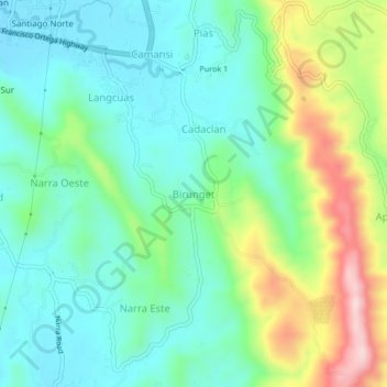
Name: Birunget topographic map, elevation, terrain.
Location: Birunget, La Union, Ilocos Region, Philippines (16.57885 120.33329 16.61885 120.37329)
Average elevation: 338 ft
Minimum elevation: 33 ft
Maximum elevation: 1,070 ft