
Thank you for supporting this site ❤️
Make a donation
Make a donation
Gear up for your next adventure:
As an Amazon Associate, this site earns from qualifying purchases at no extra cost to you.
Dikkebus topographic map
Click on the map to display elevation.
Thank you for supporting this site ❤️
Make a donation
Make a donation
Gear up for your next adventure:
As an Amazon Associate, this site earns from qualifying purchases at no extra cost to you.
About this map
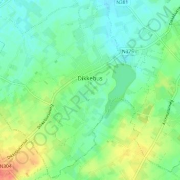
Name: Dikkebus topographic map, elevation, terrain.
Location: Dikkebus, Ypres, Ieper, West Flanders, Belgium (50.79701 2.78976 50.83647 2.85394)
Average elevation: 102 ft
Minimum elevation: 52 ft
Maximum elevation: 197 ft
Thank you for supporting this site ❤️
Make a donation
Make a donation
Gear up for your next adventure:
As an Amazon Associate, this site earns from qualifying purchases at no extra cost to you.