
Upper Quezon Hill topographic map
Interactive map
Click on the map to display elevation.
About this map
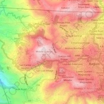
Name: Upper Quezon Hill topographic map, elevation, terrain.
Location: Upper Quezon Hill, Baguio, Benguet, 2600, Philippines (16.39647 120.55648 16.43647 120.59648)
Average elevation: 4,590 ft
Minimum elevation: 3,540 ft
Maximum elevation: 5,194 ft