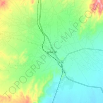
Qilla Abdullah topographic map
Interactive map
Click on the map to display elevation.
About this map
Name: Qilla Abdullah topographic map, elevation, terrain.
Average elevation: 5,220 ft
Minimum elevation: 4,895 ft
Maximum elevation: 6,017 ft

Click on the map to display elevation.
Name: Qilla Abdullah topographic map, elevation, terrain.
Average elevation: 5,220 ft
Minimum elevation: 4,895 ft
Maximum elevation: 6,017 ft