
Te Whekau Lagoon topographic map
Interactive map
Click on the map to display elevation.
About this map
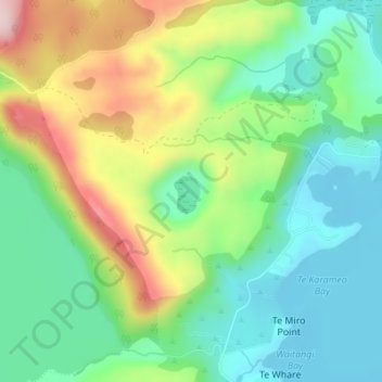
Name: Te Whekau Lagoon topographic map, elevation, terrain.
Average elevation: 1,289 ft
Minimum elevation: 978 ft
Maximum elevation: 1,877 ft
Other topographic maps
Click on a map to view its topography, its elevation and its terrain.
Lake Tarawera
New Zealand > Bay of Plenty > Lake Tarawera
Lake Tarawera, Rotorua District, Bay of Plenty, New Zealand
Average elevation: 1,358 ft