
木曽町 topographic map
Interactive map
Click on the map to display elevation.
About this map
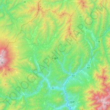
Name: 木曽町 topographic map, elevation, terrain.
Location: 木曽町, 木曽郡, Préfecture de Nagano, Japon (35.78904 137.47617 36.02680 137.82829)
Average elevation: 4,485 ft
Minimum elevation: 2,228 ft
Maximum elevation: 9,990 ft