
三角镇 topographic map
Interactive map
Click on the map to display elevation.
About this map
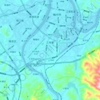
Name: 三角镇 topographic map, elevation, terrain.
Location: 三角镇, 梅江区, 梅州市, 广东省, 中国 (24.23038 116.08523 24.29350 116.17730)
Average elevation: 397 ft
Minimum elevation: 236 ft
Maximum elevation: 1,755 ft
Other topographic maps
Click on a map to view its topography, its elevation and its terrain.