
Plummer topographic map
Interactive map
Click on the map to display elevation.
About this map
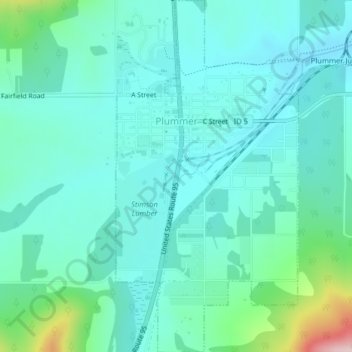
Name: Plummer topographic map, elevation, terrain.
Location: Plummer, Benewah County, Idaho, 83851, USA (47.31733 -116.89544 47.34449 -116.87461)
Average elevation: 2,802 ft
Minimum elevation: 2,638 ft
Maximum elevation: 3,517 ft