
Machareti topographic map
Interactive map
Click on the map to display elevation.
About this map
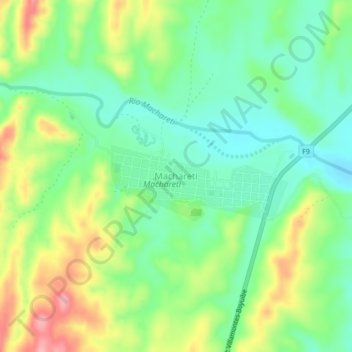
Name: Machareti topographic map, elevation, terrain.
Location: Machareti, Provincia Luis Calvo, Chuquisaca, Bolivia (-20.83514 -63.38121 -20.79514 -63.34121)
Average elevation: 2,192 ft
Minimum elevation: 2,041 ft
Maximum elevation: 2,444 ft