
Nairabein Park topographic map
Interactive map
Click on the map to display elevation.
About this map
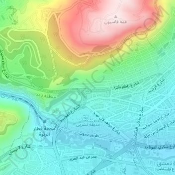
Name: Nairabein Park topographic map, elevation, terrain.
Location: Nairabein Park, Muhajireen, Al Muhajirin, Damascus, Syria (33.52209 36.26713 33.52283 36.26896)
Average elevation: 2,723 ft
Minimum elevation: 2,254 ft
Maximum elevation: 3,766 ft