
O Cerrado topographic map
Interactive map
Click on the map to display elevation.
About this map
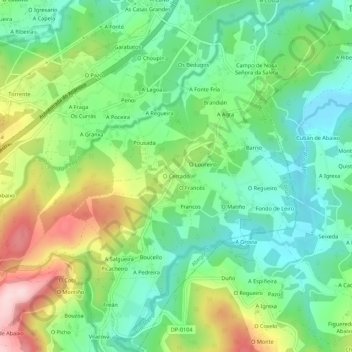
Name: O Cerrado topographic map, elevation, terrain.
Location: O Cerrado, Leiro, Abegondo, Corunha, Galiza, 15318, Espanha (43.17348 -8.29697 43.21348 -8.25697)
Average elevation: 564 ft
Minimum elevation: 236 ft
Maximum elevation: 1,168 ft