
Kanaal Bocholt-Herentals topographic map
Interactive map
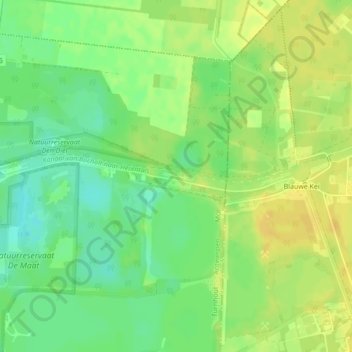
Click on the map to display elevation.
About this map
Name: Kanaal Bocholt-Herentals topographic map, elevation, terrain.
Average elevation: 118 ft
Minimum elevation: 72 ft
Maximum elevation: 154 ft
Other topographic maps
Click on a map to view its topography, its elevation and its terrain.
Millegem
België > Vlaanderen > Mol > Millegem
Millegem, Mol, Antwerpen, Vlaanderen, 2400, België
Average elevation: 82 ft