
Montaña Encantada topographic map
Interactive map
Click on the map to display elevation.
About this map
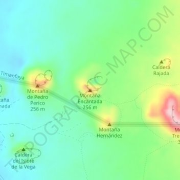
Name: Montaña Encantada topographic map, elevation, terrain.
Location: Montaña Encantada, Yaiza, Las Palmas, Canarias, España (28.98891 -13.79759 28.98901 -13.79749)
Average elevation: 472 ft
Minimum elevation: 253 ft
Maximum elevation: 1,007 ft
Other topographic maps
Click on a map to view its topography, its elevation and its terrain.