
Boxtel topographic map
Interactive map
Click on the map to display elevation.
About this map
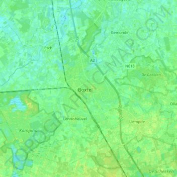
Name: Boxtel topographic map, elevation, terrain.
Location: Boxtel, North Brabant, Netherlands, The Netherlands (51.54349 5.24618 51.63463 5.40520)
Average elevation: 26 ft
Minimum elevation: 10 ft
Maximum elevation: 49 ft
Dutch Topographic map of Boxtel (place), March 2014.