
Deep River topographic map
Interactive map
Click on the map to display elevation.
About this map
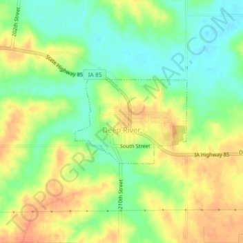
Name: Deep River topographic map, elevation, terrain.
Location: Deep River, Poweshiek County, Iowa, United States (41.57650 -92.38179 41.58590 -92.36516)
Average elevation: 869 ft
Minimum elevation: 797 ft
Maximum elevation: 938 ft
Other topographic maps
Click on a map to view its topography, its elevation and its terrain.
Brooklyn
United States > Iowa > Poweshiek County
Brooklyn, Poweshiek County, Iowa, United States
Average elevation: 866 ft
Grinnell
United States > Iowa > Poweshiek County
Grinnell, Poweshiek County, Iowa, 50112, United States
Average elevation: 981 ft