
Drummoyne topographic map
Interactive map
Click on the map to display elevation.
About this map
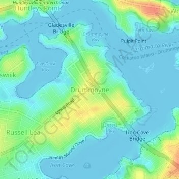
Name: Drummoyne topographic map, elevation, terrain.
Average elevation: 36 ft
Minimum elevation: -16 ft
Maximum elevation: 154 ft
Other topographic maps
Click on a map to view its topography, its elevation and its terrain.
Oran Park
Australia > New South Wales > Sydney
Oran Park, Sydney, Camden Council, 2570, Australia
Average elevation: 305 ft